Hello Friends! It feels great to pick up the virtual pen yet again. Yes! And this time it is with my new Thinkpad 520. Anand and me had been holding a US Visa and after our trip to Seattle had been wanting to explore our existence past the great environs of Canada. We both have a terrific ability to sneak beyond the definitions of maps to graze past the dominions of nature's behold - and this time it was the Yellowstone National Park in the United States. While Monojit was old to our legion, Soumya had joined anew and it would be his first long trip with us. This trip once again like the earlier ones was a runaway success with us smoking the wheels to the likes of 2640 kilometers.
 |
| Wild Bison Flocking - Yellowstone Park - Exotically Exquisite |
6-Oct-2011
It all started on this day. As our trusted Rental Company, we picked up our SUV from the National Car Rental Agency on 10th Ave SW. We were provided with two options - A Jeep and A Hyundai Santa Fe. We had never driven a Santa Fe before and decided to go with it. That was not a wise decision as I later learnt. Sorry to the Hyundai fans sitting out there, but I do not have high regards for their vehicles and within 10 minutes of riding, I decided I could not drive it for the entire trip. Within minutes of me making the decision, I was glad to hear the same opinion coming from the passengers. It had a jittery suspension, an uncanny rattle, a bad tendency to understeer and worse still, a bad ride. After making our purchases for the trip that day which ran to almost half a grand, we parked the vehicle home only to change it the next day.
7-Oct-2011 - The Trip Commences
Distance Covered: ~520 KM
Route Map: Calgary, For MacLeod, Lethbridge, Coutts, Sweetgrass (Sunburst, USA), Great Falls (Montana)
 |
| Day 1 - Map |
After running some errands and getting the vehicle exchanged for a Ford Edge during lunch, we wrapped up our office work on this Friday, and started for the US Border at Sweetgrass.The drive South to the US was on our much traversed route viz. HWY 2A. The US Border at Sweetgrass is about 340 KM from Calgary. About 200 KM short of reaching the US, we discovered that there would be Visa Complications for Monojit as he was not carrying his PR Card (discovered at the 11th hour), but we still decided to take a chance and drove on. We reached the Border amid some tense moments, and after a little commotion we finally were able to get into the US. The drive further South into the US was a pleasant one - Interstate HWY-15 was smooth and I was able to make the most of the manual shift on the vehicle with speeds averaging 80 MPH (~128 KMPH). Taking a pit stop for fuel and dinner in between, we drove 200 KM from the border to reach Great Falls (in the state of Montana) at midnight. The suite we took at the Holiday Inn was roomy and comfortable.
8-Oct-2011 - Entry Into Yellowstone
Distance Covered: ~700 KM
Route Map: Great Falls, Bozeman, Yellowstone West Entrance (All in the State of Montana),
Lower Geyser Basin (Fountain Paint Pots), Midway Geyser Basin (Excelsior Crater), Yellowstone South Entrance, Jackson Hole (All in the State of Wyoming)
 |
| Day 2 - Map |
We were all geared up for the day's jaunt, well not exactly a jaunt but an elaborate thread of joyful riding across two states of the USA - Montana and Wyoming. We were able to push out of Great Falls by quarter to ten.
 |
| L-R: Soumya, Self and Anand |
Driving down Interstate 15 took us through some of the most picturesque vast open stretches of Prairies, interspersed with lovely Hillocks all along the way. This was a tad different from the familiar Canadian Landscape, which is equally beautiful, but different in the sense that the land is less undulating, thereby exposing a vaster stretch of Mother Earth, making you feel that you can actually sense the earth's spheroidal nature.
 |
| South on I-15 |
 |
| Miles Of Scenery All Around |
Having driven about 1/2 an hour on the IS-15, being treated with the miraculous spell of stunning beauty of Mother Nature all through, we decided to pull over the curb at one of the scenic spots. It was historical as well - The Saint Peter's Mission.
 |
| Anand @ The St. Peter's Mission |
I must admit, the people who chose to earmark this spot must have been splendid in their senses to probe the most beautiful spots amongst an already 'Hungry-to-be-crowned' chain of locations. The hills rose just as much above, as to seem big, and yet allow a peek of a beautiful Truss structured bridge a few miles across.
 |
| The Bridge On Truss From The Viewpoint |
 |
| L-R: Self and Monojit |
One thing which I observed conspicuously was Soumya's passion for photography. The gentleman is good at his work with his Canon SLR, so much so that you have to pester him to get his image into the photographs, the ones which can be jointly called as Group Snaps. We stopped at just one Fuel Station before my foot hit the deceleration pedal at the I-90 Crossing. It was Coffee Time for some, Snack Time for the rest and both for those who love the concept of interjection.
 |
| Our SUV Being Refueled |
The drive further South was pretty much the same, with beauty strewn around all nooks and corners. I could imagine the plight of the Judges in a Beauty Pageant at those junctures, when I put myself in their shoes, trying to judge which of those spots would give me the Album Cover for the trip.
 |
| Merging Into I-90 |
I was finally relieved of the responsibility of making this choice (well, at least for the time being) when a Dead End on the Highway made me (rather my GPS device) chose the IS-90 to the East. I was liking the way the Ford Edge was behaving to Gear Shifts and handling round the corners. Though still on the number side, this American car has risen beyond expectations to offer a smooth joyous ride.
While conversing on the technical jargon of how this Ford was better than the previous generations, which I believe must have been pretty boring to the listeners, I found a welcome respite - a beauty spot - The Bozeman Trail.
 |
| The Bozeman Trail |
After a neat pit stop at the Trail, we proceeded with our journey. The mountains began to surface nearer as we approached Bozeman. As much as they did, they also brought the snow closer. Our rules of taking a pit stop asked us to stop by a lake.
 |
| Snow Beginning To Appear Nearing Bozeman |
I could now make out the difference in terrain. Though avidly still flat, it had begun to offer more bends and all the same opportunity to me to test them with the manual stick. We had a long afternoon break at Bozeman. It served as a good replenishment for the vehicle and for me, the sole driver. Bozeman can be roughly equated to be half way between Great Falls and Jackson Hole, which would be our destination for the night.
 |
| Bozeman, MT |
Our intention was to enter Yellowstone from the Western Gate, which is about 140 KM from Bozeman (approximately 1 hour and 45 minutes). The road is marked by a significant reduction in speed as you approach the park, and also with vividness of flora and fauna that dot the entire geography, reassuring you that you have indeed entered the park. Our plan for the day was to traverse the Western Arm of the Park and find accommodation for the night. The sight of wild animals greeting the eyes in the all so wild environment was beginning to give me the feeling of being in a Safari.
 |
| A Bison Spotted In Between |
 |
| With A Deer In The Background |
The speed limit was 40 - 45 MPH at most places inside the park, and we were stopping at many spots to relish the beauty of the place. We entered the park by 4 PM. Somu Da (Soumya) and Anand had taken detailed maps of the place and we knew how to traverse the place. While driving down to the Geyser Basin, we stopped by at The Plateau of Fire. This place was once active with volcanic activity and there was a waterfall there.
 |
| Firehole Falls In The Plateau of Fire |
 |
| The Sign Mark |
Yellowstone West is famous in the world for its Hot Springs and Geysers. The area is huge and Geyser activity is spread across many locations. Driving further South we reached the first of the Geyser Spots - The Lower Geyser Basin. This is the starting point of the Geyser Basin. There are a few Hot Springs doting this area and from here you can see the steam rising from the numerous geysers of the Midway Geyser Basin. Upon entering this area, I immediately steered the vehicle to the Hot Spring to our right which had some subdued activity. It also looked like the Wild Bison was on the loose in this entire territory. It could be spotted almost everywhere in the park.
 |
| The First Hot Spring In The Lower Geyser Basin |
 |
| Our Vehicle Parked Along The Curb |
 |
| The Complete Group Next To The Second Hot Spring |
 |
| A Close Up Of The Hot Spring Shown Above |
 |
| A View Of The Geysers Near Fountain Paint Pots |
After covering this first sport, we moved further down to The Lower Geyser Basin, which is a densely packed region of Hot Springs and Geysers. A 0.5 mile (0.8 KM) long boardwalk has been beautifully and meticulously placed in this area that threads through each one of the active spots. The area is pretty elaborate and you could spend hours at this spot. It was about quarter to 6 in the evening the the wind had begun to step up on its pace, bringing some skin-whipping chill along with it.
 |
| At The Beginning Of The 0.8 KM Boardwalk |
 |
| A Non Oxygen Dependent Microbial Form Of Life Thriving On Heat And Sulphur |
 |
| Deep Turquoise Coloured Hot Spring |
 |
| Fountain Paint Pots - A Series Of Highly Active Low Exploding Geysers |
 |
| Geyser Eruption In Progress |
 |
| Another Highly Active Member Of The Paint Pots |
You can smell sulphur all along the Boardwalk. Towards the Northern Edge, the region is marked by Geyser Eruptions going up to almost 5 meters. We continued to walk along the Boardwalk, our steps growing into strides, so as to enable us to cover the distance to our vehicle at the double. This was a clear indication of the wind gusts growing chillier.
 |
| Map Of Yellowstone - Western Arm Covered On The Second Day |
After wrapping up with this place we started our travel further South to the Excelsior Crater. The difference between the geysers here and at other places is that the ones over here are very much larger in surface area than the others. Getting a feeling of being surrounded by Geysers and smoke is commonplace to the entire park, and this region was no different.
 |
| Hot Water Stream Near The Crater |
 |
| Splendid Serenity - The Bridge Connecting Over To The Crater |
 |
| The Excelsior Geyser Crater |
It was 7 PM and had grown quite dark when we finished our tour of the Excelsior Crater and the surrounding geysers. Our target was to find some accommodation now. We wanted to stay within the confines of the park, as that would give a wonderful night time feeling. The nearest and furthest settlement down South was the Grant Village. But the only Hotel there was way too expensive, so much so that the option to travel 125 KM South to Jackson Hole worked out much cheaper. Exiting out of the South Entrance of the Park, we comfortably reached Jackson Hole and were able to get a nice hotel for the night.
9-Oct-2011
Total Distance Covered: ~ 400 KM
Route Map: Jackson Hole, Colter Bay, Yellowstone South Entrance, Jackson Lake Junction, Lewis Lake, Old Faithful, Gibbon Falls, Canyon Village (North Rim of Grand Canyon), Yellowstone East, Cody
 |
| Day 3 - Map |
We were greeted by a wonderful fog-laden-misty-mountain-top in front of our hotel suite when we got up in the morning. The old wooden structures of the hotel added to the exotic blend of the already picturesque environs. After munching on a light breakfast we got ourselves ready to start our third leg of the tour.
 |
| The Hotel At Jackson Hole - Old And Elegant |
 |
| Anand And Me |
 |
| The Misty Mountain Top Adding To The Beauty |
We were out of Jackson at quarter past 10. The drive North into Yellowstone was scenic and lined with multi-shaded tress exhibiting the colours of fall. 25 KM North of Jackson and an equal distance South of Colter Bay I came across this strange driver in a Mercedes ML-350, who I think, no believe, was purposely irritating me with his antics of completely slowing down and then suddenly increasing his speed when I tried to overtake. I have had a fair hand of my experience behind the wheel and know what some of the drivers can be up to.
 |
| The Mercedes ML-350 With A Nutty Driver |
I am no hermit and I chose to participate in the fun. I stepped up on the gas and ran over the posted speed limit by a thick margin to overtake the guy. Now, I got the lead and gave the guy a taste of his own recipe. The game carried on until we reached the Southern gates of the Yellowstone Park.
 |
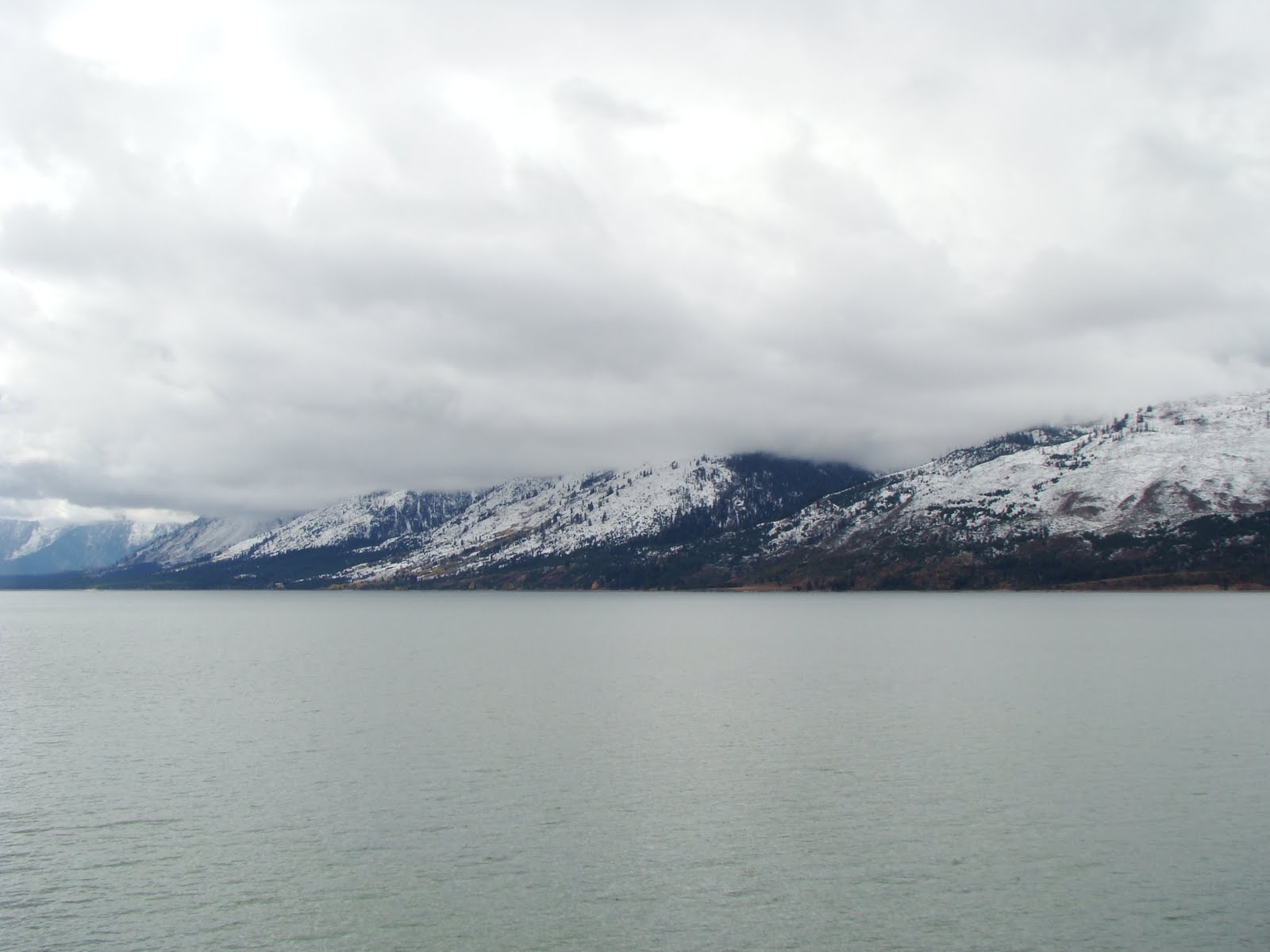
| The Southern Part Of The Park Flanked By Icy Mountain Ranges |
 |
| South Yellowstone Entrance |
After entering Yellowstone, we stopped by at a scenic spot to record some good colours on our cameras. The colours were striking, specially Orange and Yellow which were completely saturated in their tones.
 |
| Our First Stop Of The Day - Lovely Fall Colours |
 |
| Nice To Enjoy Weather - Manageable With A Pullover |
 |
| Amazing Beauty Studded Along The Way |
A little further North we stopped again at the Jackson Lake Junction. This time the colours of the falls were blended with the icy mountain caps. It was another marvel of nature that we did not want to miss capturing in our cameras.
 |
| Jackson Hole Junction |
 |
| Mixing Of Colours With White In The Backdrop |
 |
| Yes, There Are Signs To Warn You Of Horses On The Road! |
Our next stop was at the Colter Bay Center. This place is on the Eastern bank of Jackson Lake.
 |
| Colter Bay |
 |
| Jackson Lake, The Stop After Colter Bay |
 |
| Jackson Lake |
We reached Lewis Lake at 1 PM. The area was far chillier than the ones we had visited earlier in the day. Fishing is allowed in the lake with permit.
 |
| Lewis Lake Marker |
 |
| Snow Near The Lake |
 |
| A Motor Boat |
 |
| Lewis Lake Ramp |
 |
| Anand and Somu Da |
The major points that we wanted to cover on this day were the Old Faithful Geyser and the North Rim of Grand Canyon. About 30 minutes South of Old Faithful, while driving on the Western arm of the Park, we stopped by at a mini brook, which had been decorated with what I could contemplate as cobbles of packed snow.
 |
| 30 Minutes South Of The Old Faithful Geyser - Snow Cobbles |
 |
| Ramp To Old Faithful & Madison, Still Further North |
 |
| Gotta Wait For The Geyser To Erupt |
 |
| L-R: Somu Da and Me |
I shifted into Neutral at 2:20 PM after having reached Old Faithful. This is one of the most famous Geysers of this Park and lies South of all the other Geyser Basins of the Park, though from this, you can see in the near distance, some of the Geysers and Hot Springs of the Upper Geyser Basin. There are patterns that have been observed, studied and applied to the eruptions of this great Geyser. This place also boasts of a wooden Boardwalk as most of the other spots in this Park. The difference being, that the walkway is placed much further apart from the craters, as the explosive activity of the Geysers here is much more powerful.
 |
| Old Faithful's Wooden Boardwalk |
 |
| The Old Faithful |
 |
| 180 Degrees Opposite To The Above View |
 |
| The Blue Star Spring |
 |
| The Chinese Spring |
 |
| L-R: Monojit And Me |
 |
| Near The Observation Point |
 |
| Connecting Bridge To The Observation Point |
 |
| Me |
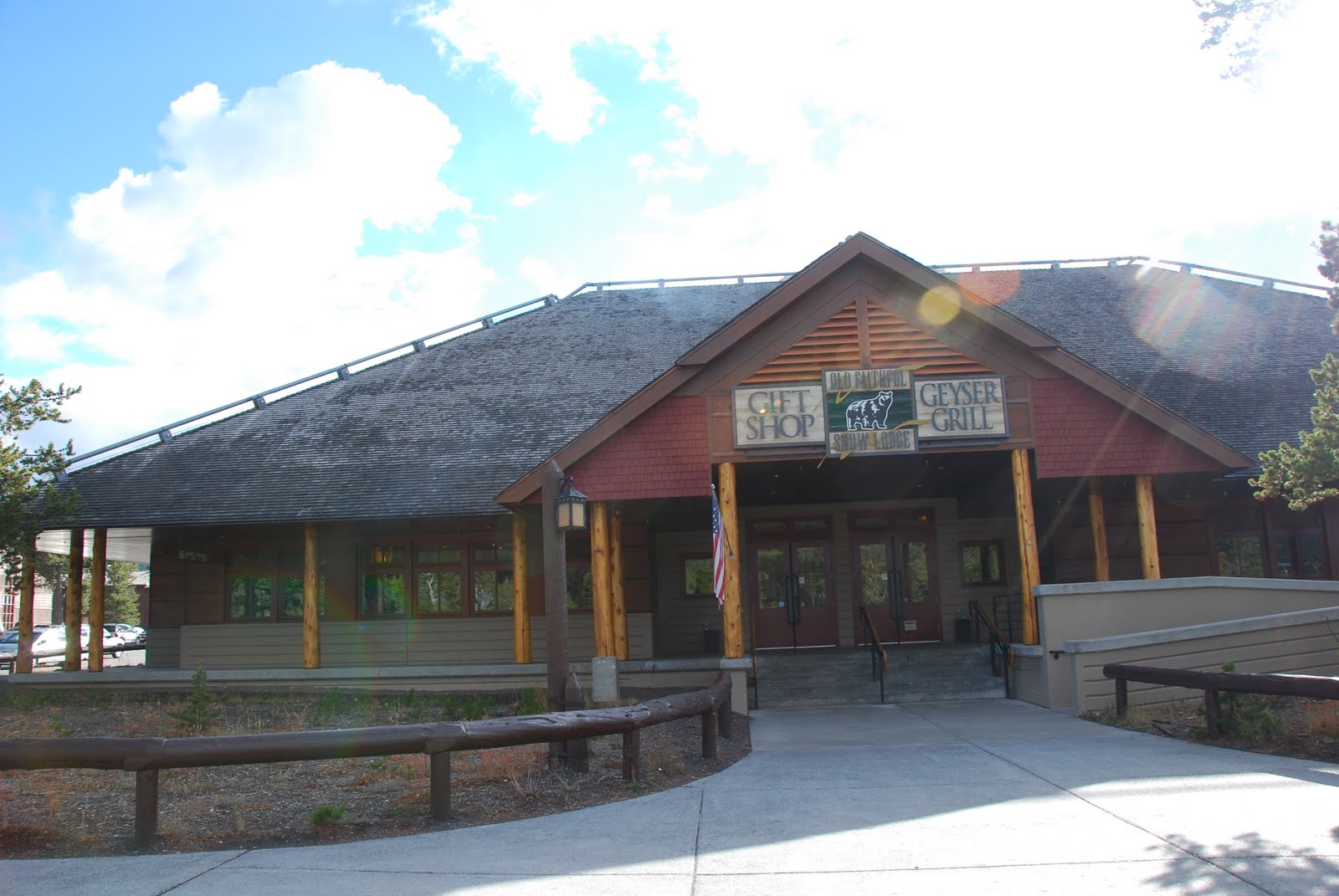
The tour of this place was over by 3:30 PM and we had become hungry tigers, ready to devour any food that was presented to us. So we set out on a food hunt, that took us to the Visitor's Center and then to the Old Faithful Snow Lodge. I savoured the tasty Park Special Burger at the Grill.
 |
| Old Faithful Visit Center |
 |
| Old Faithful Snow Lodge |
|
We spent a considerable amount of time in the Gift Shop, where everybody picked up souvenirs. I picked up a sweatshirt, a colour changing coffee mug and 3 Silver Coins.
 |
| In The Freshly Purchased Merchandise |
We pushed off from Old Faithful at 4:30 PM and headed North-West on the Western Arm of the Park to Gibbon Falls (Teton, WY). The distance is about 36 KM, and takes approximately 30 minutes if driven without stops. About 20 minutes from the start of our journey, we were stopped by a huge barricade of vehicles - mostly SUVs, a few cars and some RVs (Caravan In The Indian Context). It was was as though a whole convoy had stopped by for some important work, and the important work was not tough to be determined by onlookers like us - there was an entire generation of Wild Bison that had flocked the area, and why not? This is the place they get to boss around, at least they lead their lives peacefully in this secluded area, which we humans have had the courtesy to save from being deforested.
 |
| Herd Of Wild Bison - A Few KM South Of Gibbon Falls (Teton) |
 |
| This Is My Land (Says The Bison) - There Are No Signals, And You Gotta Stop For Me!!! |
 |
| See That Posted Limit? Now You (Vehicle Owners) Better Slow Down When You See Me |
We opened the Sun Roof of our SUV to click some marvelous photos of these beasts. It was fun to watch the animals walk freely without fear with their fellow beings. The older and more masculine males who aptly fitted the Alpha category, had in particular, a certain air of haughtiness around them. They walked with a swagger - slow, yet purposely exhibiting an intent to throw their weight around to show dominance. After a long stop in our vehicle to watch the Bison, we reached Gibbon Falls at 5:20 PM.
 |
| Gibbon Falls, Teton, Wyoming |
 |
| River In The Background |
 |
| Observation Point For The Falls |
 |
| The Falls |
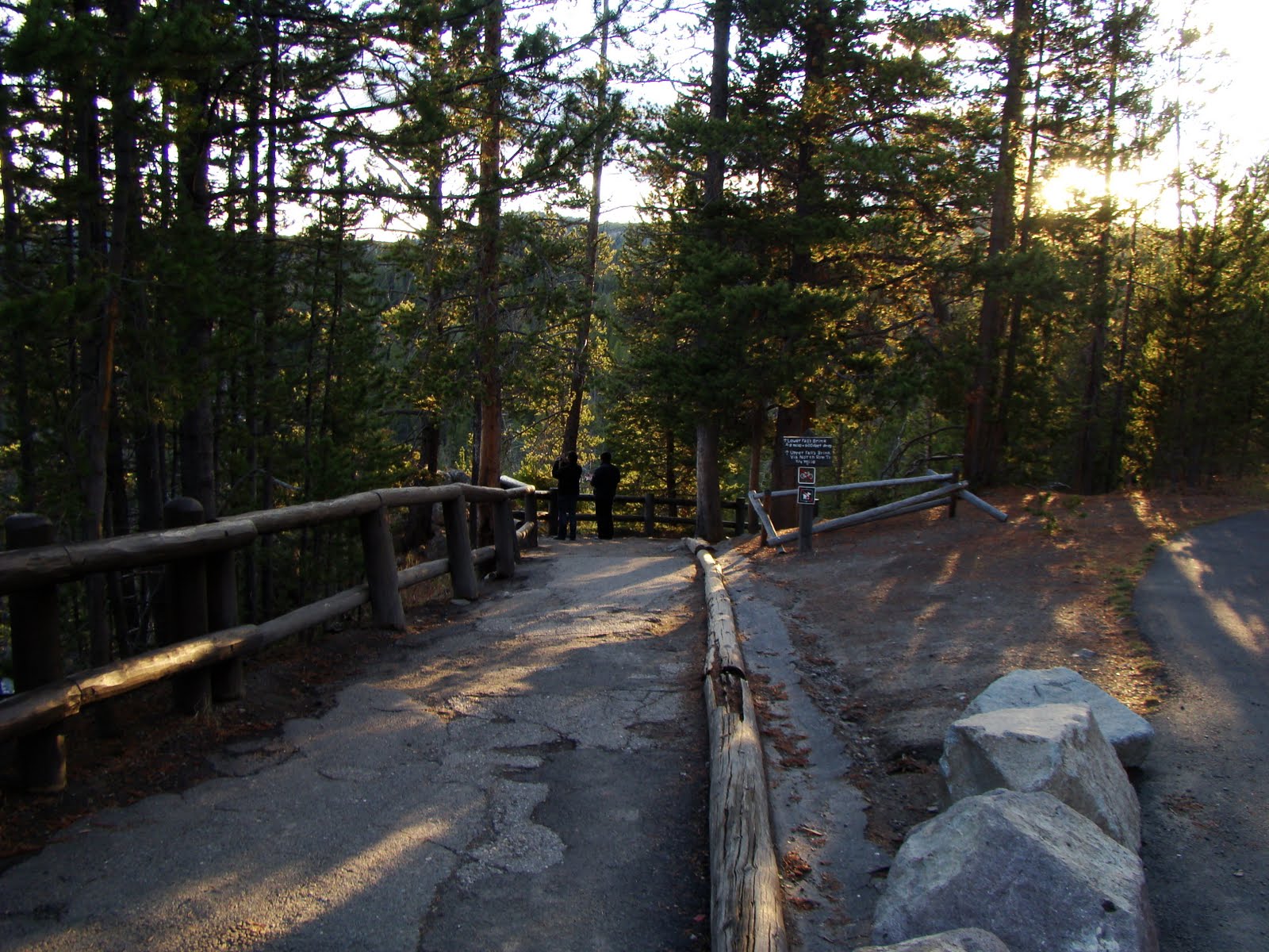
This was a refreshing place for me as I had been feeling sleepy after the hearty lunch. The cold and damp air was good enough to wear away the sleepiness. The next attraction on our agenda for the day was the "Grand Canyon Of Yellowstone". From Gibbon Falls, it is another 33 KM (30 minutes) to the West. There are two rims which serve as major attraction spots. As it was growing dark, we were able to cover only the North Rim on this day.
 |
| Our Guiding Markers |
 |
| To The View Of The Canyon From The North Rim |
At 6:15 PM, our vehicle was firmly parked on the North Rim Drive. The weather pattern here was just like any other Hill Town - warmer in the morning and steadily freezing as the sun went down the horizon.
 |
| Trail To The Lower Falls |
 |
| Brutal Descent Of About 250 Meters To The Lower Falls |
 |
| Yellowstone River Cutting The Canyon |
 |
| The Trail Treacherously Continues Down |
 |
| The Lower Falls - Seen From The North Rim |
 |
| The Grand Canyon As Seen From Lower Falls |
We completed our trek down the trail and came up after seeing the Grand Canyon of Yellowstone. The trail was marked with deep descent and consumed lots of energy. This finished off the day's excursion list and we started from the Canyon at 7 PM. We made a brief fuel stop at a nearby Gas Bunk. There were two elderly ladies driving up from far South who wanted to go to Livingstone and had lost their track. They were looking for help and we pulled out our GPS and wrote down directions for them. This exercise over, we started East, 150 KM to a town called Cody in Wyoming. In between we stopped at a few spots to try out our night photography skills.
 |
| The Moon Captured In The Darkness |
 |
| Buffalo Bill Reservoir At Night |
Before descending into the plains, the road passes through the narrow, tough and winding bends presented by the Absaroka Mountain Range. The road is so very narrow and so steep, that you have to push into lower gear at all times during the descent. I liked this part of the journey very much. I was on the higher side of the meter, despite the posted speed and enjoyed the drive thoroughly.
We found refuge in the Best Western Hotel at Cody for the night. Monojit was searching for some good deals on electronics items and we also went around seeing some electronic stores.
10-Oct-2011
Distance Covered: ~350 KM
Route Map: Cody, Buffalo Bill Dam, Yellowstone East Entrance, Grand Canyon From South Rim Drive, South Rim Trail, Uncle Tom's Trail, Artists Point, Mammoth Hot Springs, Yellowstone North Entrance, Livingstone (Montana)
 |
| Day 4 - Map |
 |
| Best Western Cody |
 |
| Our Vehicle Parked In Front Of Our Suite |
This would be our last day in the Park. After having breakfast in the hotel we left Cody at 11 AM. About 17 KM West of Cody is the Buffalo Bill Dam. It is built on the Shoshone River, construction of which started in 1905 and was completed in 1910.
 |
| Buffalo Bill Reservoir |
 |
| The Winch Used To Pull Cables And Plug Balls |
 |
| The Road Cuts Through The Tunnel |
 |
| Ball Plug Documentation |
 |
| Ball Plug Used To Control Water Flow |
Before tackling the mighty Absaroka Mountain Range (which is a part of the US Rockies), we stopped by at a small road side scenic spot. Monojit got injured in an unfortunate incident of slipping from the car top at this place after which he remained subdued and docile in the rest of the trip.
 |
| Road Side Scenic Spot |
 |
| Absaroka Mountain Range |
 |
| Yellowstone East Entrance |
 |
| The Sharp Bends Continue |
 |
| Pit Stop At Sylvan Lake |
 |
| Next Stop At Yellowstone Lake |
 |
| Wildfires Consume Lot Of Forests - The Windy Conditions Act As Carriers |
 |
| Icy Mountains Made The Wind Feel Like A Sharp Knife |
After making Pit Stops At Sylvan Lake and Yellowstone Lake, we reached The Canyon Village at about 2 PM. We were going to see some more falls and a different and more holistic view of the Grand Canyon from the South Rim Drive. Anand and me hiked down the entire trail to the bottom of the Canyon using Uncle Tom's Trail. There is a mile long trek to the Artists Point as well, but we did it by car.
 |
| Upper Falls As Seen From South Rim Drive |
 |
| We Did The First Two |
 |
| Words Of Caution |
 |
| Steep Descent |
 |
| Lower Falls & The Lookout On The North Rim Side, Where We Were The Previous Day |
 |
| Lower Falls |
After getting back to the top, we boarded our car to Artists Point. The hike to Artists Point must have been pretty scenic but we did not have the time.
 |
| Artist Point |
 |
| Grand Canyon From The Artist Point |
At 4 PM we started for our next destination - The Mammoth Hot Springs. The GPS would have taken us through the North-Western Arm of Yellowknife, but we decided to traverse the much longer North-Eastern arm, which was much more picturesque. There were a few stops we made in between, some at marked scenic spots, and the others at our will. The first one was about 20 minutes from the start of our journey., where the road, after negotiating a few kilometers of bends opened up sight unto the far seeing slope of the hills.
 |
| Wood Replaces The Culverts |
 |
| The Slope Undulates Evenly Into The Valley |
 |
| Parked The Vehicle Just To The Left (Right If Seen From Here) After Negotiating The Curve |
20 minutes further North, we stopped by at quite an attractive place. This was very near to the Tower Fall. The road was very narrow here, the left side of which was being overlooked by a flat high cliff, made of columnar basalt.
 |
| Columnar Basalt Near Tower Fall |
And only a few minutes North of this place, there is a beautiful lookout from the Speciman Ridge that gives a nice view of the Yellowstone Canyon.
 |
| Near Speciman Ridge, Yellowstone Canyon |
 |
| Yellowstone Canyon |
 |
| The River Cutting Through The Canyon |
 |
| Wooden Railings |
 |
| The Trail Has Been Made Into An Arch Type Structure |
After this point, the road reaches the plains yet again and the posted speed limit rises up than in the curvaceous hills. It must have been a perfect moment for us, as the land mass surrounding the road started to grow a bit higher in level than the road itself, and at the same time it seemed to merge into the horizon. At this juncture the clouds seemed to have strayed down into the lowlands and they cast a lovely purple spell on the colour specifications of the sky. I immediately parked the SUV in whatever small space I could find on the no-shoulder road, taking care that there was enough room for passing cars and scurried a few hundred meters back. The snaps below were captured by me on my DSC-H7 at this spot.
 |
| Purple Skies Falling Down On The Horizon |
 |
| Looks As Though The Earth Is Touch The Sky |
We reached Mammoth Hot Springs after sunset. It must have easily been 6 in the evening. Apart from Monojit, who was perturbed with his fall the previous day, the rest of us scanned the area pretty neat.
 |
| Liberty Cap, Mammoth Hot Springs |
 |
| Hot Spring Terraces |
 |
| From Atop The Terrace |
At quarter to 7, we were out of Yellowstone, taking the Northern Entrance as the exit. We stopped at Livingstone, Montana which is about 100 KM from Mammoth Hot Springs for the night.
 |
| Exiting The Park |
11-Oct-2011
Distance Covered: ~800 KM
Route: Livingstone, Coutts (US-Canada Border), Calgary
This was the last day of the trip. It was a long drive with many pits stops.
 |
| Random Snap - Last Day |
 |
| Random Snap - Last Day |
 |
| Random Snap - Last Day |
 |
| Random Snap - Last Day |
 |
| Random Snap - Last Day |
 |
| Just Hitting The Pedal To Reach Canada Soon |
 |
| Back To Wild Rose Country |


Excellent stuff. Felt very nostalgic when read your blog in detail. I am planning to take a printout of this complete blog & keep it with me!! It certainly helps me to cherish that journey together, throughout my life (specially in my old age :-))!!!
ReplyDeleteThanks Somu da! Having you is a pleasure on the trips!! Also your comments are so motivating for me to write the next blog now!!
Delete