
One Of The Only Three Roads In The World That Cross Arctic Circle
Time - 8 Sept 2010, 10:19 PM MDT
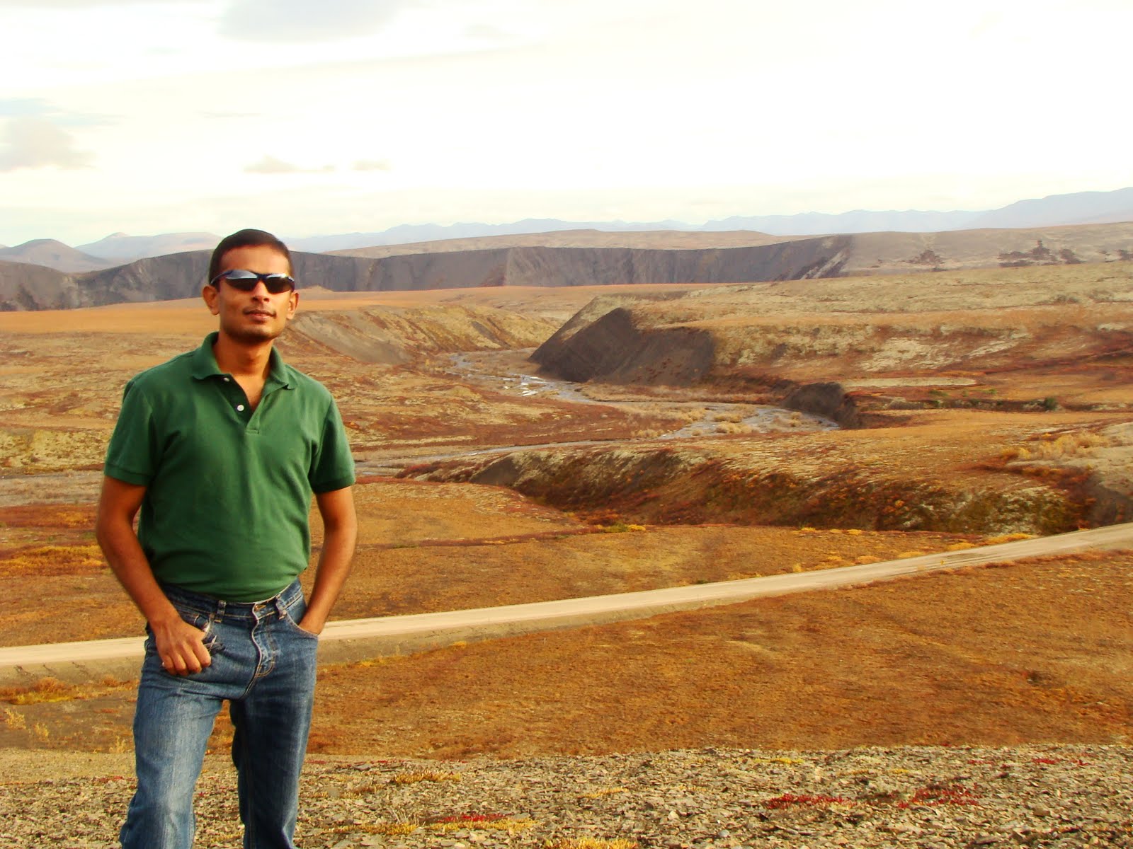
Vehicle - My Rented 5.3 L V8 Trailblazer
 |
| Northern Light - approx 2 AM @ Tuktoyaktuk |
On The Arctic Circle the Sun never sets for one complete day in a year and then never rises for one complete day in that year.... At the North Pole however, the Sun never sets for 6 full months and never rises for the next 6 months.... Everywhere else in between, the spectacle is more profound than the Arctic Circle, but lesser than at the Pole....... Read On
(Please see videos and glossary at the end)
(Please see videos and glossary at the end)
N.B. I have composed seven videos of the trip. These would enable you get a good picture of the environment before reading the blog -
Germination Of The Idea And Seeding The Plan
It infuses in me a prominent surge of pride and valour and gives me that sweet smell of achievement after joining the ranks of the very selected few who have done this. For that, I must thank my friend Piyush Agrawal who stood by me and dared to take this challenge considering the fact that undertaking this journey would mean standing miles away from comfort, taking risks of safety and maybe life at each step, and last but not the least the money involved. I would also like to thank my Canadian friend Michael Paget who sold me this idea sometime ago this year and I think I made the perfect buy as no other trip would have given me such a sense of pride and achievement as this one - yes I crossed the Arctic Circle - 66° 33′ North Latitude on the 6th of Sep, 2010 at 1:29 PM.
I had been harbouring the idea of driving to the northern tip of Alaska ever since I came to Canada. And I had been negotiating with people to buy in, but nothing had been working out. And one of these days I met Piyush who was willing. I have a US visa but Piyush does not, so something had to be worked out. When this idea that Michael had given came back alive. We decided to drive on the Dempster Highway up to Inuvik, Northwest Territories, the northern tip of Canada. Sept 6 was a holiday for Labor Day and we took rest of the week off for the trip.
Taking Up The Challenge
The Dempster Highway is an all weather gravel road that stretches 739 kilometres from the Klondike Lodge on YT HWY 2 (Klondike Highway) and ends at Inuvik (NWT). It is one of the only three roads that cross the Arctic Circle, the others being - The Dalton Highway, Alaska, US and Rovaneimi Honninswag Highway, Finland, Europe. It spans two gigantic northern provinces of Canada - The Yukon and The NWT. We wanted to drive down all the way from Calgary to Inuvik but shortage of time made us make an alternate plan. The route we followed is shown in the image below -

The Overall Map That We Followed
Where the points marked are -
A - Calgary, Alberta, Canada
B - Vancouver, British Columbia, Canada
B - Vancouver, British Columbia, Canada
C - Whitehorse, Yukon Territory, Canada
D - Dawson, YT, Canada
E - Eagle Plains, YT, Canada
F - Fort McPherson, Northwest Territories, Canada
G - Inuvik, NWT, Canada
The total distance from A-G is about 4618 kilometres one way. Point A to C was done by plane. There after we did all the way up to G by car. There is another place we visited - Tuktoyaktuk which is right on the tip of the Arctic Ocean and not marked here as there is no summer road till that place. It is shown in the map below and this was done by a chartered plane.

Inuvik To Tuktoyaktuk - Done In A Cessna 172 Chartered Plane
There Is No Summer Road, But Ice Road In Winter Over Lakes
Where the points marked are -
A - Inuvik
B - Tuktoyaktuk on The Arctic Ocean
Day 1 - Sept 4, 2010
Calgary-Whitehorse-Klondike Lodge
The first part of the journey was by plane to Whitehorse, Yukon. This is the southern tip of the Yukon as can be seen on the above map. We started early in the morning. Air Canada flight AC 8237 took us to Vancouver at 8 AM MDT and from Vancouver AC 289 took us to Whitehorse at 10.25 AM PDT.

We reached Whitehorse at 1.30 PM PDT. We had made our car reservations with the Norcan Leasing Company in Whitehorse. We had booked an SUV and we got a Chevrolet Trailblazer. It was a 5.3 L (5300 CC) V8 vehicle churning out a whopping 305 BHP and 441 Nm of torque. I immediately fell in love with the vehicle and its torque induced engine.

A View Of The Ground Before Landing
We reached Whitehorse at 1.30 PM PDT. We had made our car reservations with the Norcan Leasing Company in Whitehorse. We had booked an SUV and we got a Chevrolet Trailblazer. It was a 5.3 L (5300 CC) V8 vehicle churning out a whopping 305 BHP and 441 Nm of torque. I immediately fell in love with the vehicle and its torque induced engine.
The population of the entire YT is just 30,000 and Whitehorse accommodates 26,000 of them. After completing the formalities for vehicle leasing we hunted for food. The fastest method was to get a Mac. We then spent considerable time in the Real Canadian Superstore to purchase groceries that would last us long enough. We had already purchased a good amount of in-car electricals and electronics for cooking, lighting and wiring from Calgary. It was about 4.30 PM when we checked out of the store and headed for Dawson. This is about 540 kilometres and we wanted to do it before nightfall so that we could gather enough sleep for the big journey ahead on Dempster. You have to drive on Alaska Highway YT-1 for sometime before you take a right on the Klondike Highway YT-2 N.

Driving On The Alaska Highway
Till You Take A Right On Klondike
Till You Take A Right On Klondike
The vegetation here consists of Boreal forests that are stunted due to the cold climate. It was fall time and the colours on the trees were fresh. In just a few more days winter would strike in. The fall here is very boisterous although short.

The Klondike Highway - YT-2N
Fall Colours Painted On The Trees
Fall Colours Painted On The Trees
This part of Canada is totally remote and strikingly different from the various other parts I have seen. The whole thing was so stunningly beautiful that we kept stopping in between to take snaps. One such notable place where we stopped for a considerable amount of time was The Bear Lake, which is short of a place called Carmacks.

Bear Lake - Our First Pit Break
A little later we stopped at Carmacks for fuel. The price of fuel starts shooting exponentially as you keep going the North. Matter of fact there are only 2 gas stations until you reach Klondike Lodge - Carmacks and Pelly Crossing.

Taken At A Govt Maintenance Site before Pelly Crossing
We kept driving straight until we reached Pelly Crossing. It was about 10 PM at night when we reached there. We stopped for fuel but the station was closed. The air had started to freeze and it was not appropriate to stay outside any longer. There is a lovely bridge at Pelly Crossing; you have to take a left on this to reach Dawson; taking a right would take you to Mayo.

The Bridge At Pelly Crossing, 10 PM MDT (9 PM PDT)
The snap above does not seem to have been taken at 9 PM. That is because the sun sets late in summers in the Northern Hemisphere. While we were there we could see light right up till 11.30 PM. But after that it had started growing darker every moment. And when it was past 12 it had become increasingly difficult to drive as the eyes were getting strained trying to focus. We were still about 45 kilometres short of Dawson when we decided to stop for the night. We knew that to take the Dempster we had to take a right turn 40 kilometres south of Dawson. The Klondike River Lodge is just at this junction. It is not just a lodge but a life line for the Dempster as it provides gas for the oncoming journey. The lodge was closed when we reached there. We woke up the person and got a room with great difficulty after he had first declined to give us one. The room charge was 105 dollars for the night. It was a lovely little wooden cabin and provided the much needed warmth we needed.
Day 2 - Sept 5, 2010
Klondike Lodge - Eagle Plains
This was the most awaited day for us. We were going to ride up the Demspter. This is not an easy task. As exciting as it sounds, that very treacherous and dangerous it can be. The perils involved are -
1. Flat tires, as many as 3 or all 4 at once are not a rare occurrence on this road
2. No fuel for at least 370 kilometers at any given spot
3. The danger of freezing if stranded
4. Arctic Blow Outs - which can be phase 1, 2 or 3 on the open Tundra. These can blow out a complete truck.
5. No hospital or emergency services on the way.
We had a very heavy breakfast served to us in the lodge's dining room. We then went around to take snaps of the place.

Our Room At The Klondike Lodge

The Lifeline Of The Dempster - The Klondike River Lodge
We filled up gas and started on the Dempster. It gave us an enormous rush of adrenaline and at the same time a scare of the vagaries of the road. I had done a lot of research on this road by reading various articles and watching videos of Ice Road Truckers (all the seasons). There is a board marking the official beginning of the Dempster and we thought it worthwhile to capture it on the camera.

The Beginning Of The Dempster - Stairway to The Arctic
There is a warning sign at the beginning of the road which is very aptly put at the correct place. This one makes the drivers stay within their limits.

The Sermon - A Rightly Needed One
You Have To Respect This Road,
Lest You Want To Be Devoured By It
You Have To Respect This Road,
Lest You Want To Be Devoured By It
Dempster Highway is an all weather road, meaning it is built on permafrost. A normal bitumen road cannot be built in such conditions as it would crumple down after insulating the permafrost and making it melt. This would also damage the environment which is already reeling under the unbearable weight of global warming. This road is made by insulating the permafrost with thick insulating sheets. Then a berm is made by putting 8-15 feet of gravel and crushed rock. To prevent the road from caving in a mix of broken shale is applied and held together with glue. This last part is absolutely necessary but then it brings in the added danger of puncturing the tires. Glued shale stands upright at many places and is as sharp as a knife. By the time you have completed one trip on the Dempster you can easily see the wear on the tires and the sides can be seen in shreds.

Crossing The North Klondike River
At The Very Beginning Of The Demspter
At The Very Beginning Of The Demspter

Conversion To Shale - Notice The Mix Of Tundra And Boreal Vegetation
Also Seen - Remnants Of Forest Fires Of The 1990s
This part scared me a lot. I had done quite an extensive research before driving on Dempster and I always kept the vehicle in 50-70 KPH band, rarely going to 80. There have been cases where people carried 3 spares with them and all four tires blew out. Our next stop to civilization would be 370 kilometres in Eagle Plains. The permanent population of this place is 10 people.
The entire highway is lined with natural attractions and we stopped by almost at ever kilometre to see the awe striking natural beauty.

Beautiful Peaks On The Right
Notice The Contrasting Colours On The Mountain
Notice The Contrasting Colours On The Mountain

Fall Colours All Along The Way
In about 10 kilometres from the start you start seeing the Ogilvie Mountain Range which has the 2040 m high Antimony Mountain.

Beginning Of The Ogilvie Mountain Range
The various attractions until you reach the Tombstone Interpretive Centre -
10.5 km - Antimony Mountain of The Ogilvie Range20.0 km - North Klondike Range
50.5 km - Southern Boundary of Tombstone Territorial Park
53.5 km - Microwave Towers, which provide communications channel for Eagle Plains Hotel
71.5 km - Tombstone Park Campground and Interpretive Centre.

The Lake Before The Interpretive Centre
We stopped by at a lake, few kilometres south of the Interpretive Centre. We opened our in-car cooking system which derives power from the 12 V charger point. We cooked Maggi noodles and had some fruits. It had begun to rain then and our vehicle had started lapping up dozens of mud. It then gave the feeling of a real offroader. Riding north we finally made it to the Interpretive Centre. There was a tourist bus from Alaska there and some Japanese tourists.

Tombstone Interpretive Centre

Amid Colours Near The Interpretive Centre
Notice The Tundra Covered Mountain
Notice The Tundra Covered Mountain
The Treeline Has Started To Wither, Giving Way To Arctic Tundra
Just north of the Interpretive Centre, you can see the Tombstone Mountain and further ahead you have the Continental divide, which means that any water mass south of the divide flows down as a river into The Pacific Ocean and anything north of it flows into the Arctic Ocean (Beaufort Sea). You can actually see this reversal standing on the divide. As you cross the Interpretive centre you can notice the drastic change in vegetation - the treeline becomes very thin and almost disappears and the Tundra stretches into the vast expanse.

Tombstone Mountain

The Continental Divide
Every kilometer here seemed so long, the reason being - we were driving too slow. But the very picturesque sights made up for it. Now we were in the open Tundra there were no trees in sight at all. At km 102.6 we saw the Two Moose Lake. It provides for a good feeding ground for Moose.

The Two Moose Lake
The landscape after this is pretty flat for kilometres together and you drive on completely flat Tundra. A little ahead at km 116 is The Chapman Lake. We got down here seeing one of the sign boards which challenged the reader that "Walking on Tundra is not easy". We took the challenge and found every ounce of it to be true.

The Chapman Lake
The Tragic Story Of The Lost Patrol - This is a famous but tragic story. In the winter of 1904-1905 The Royal Northwest Mounted Police started conducting patrols between Dawson, Fort McPherson and Herschel Island on the Arctic Ocean. The patrols took about 50 days and followed the traditional routes of the Native people. Though the 765-kilometre route was considered very difficult by the police, it was traversed safely, except once. That was the “Lost Patrol,” in the winter of 1910-1911. Traveling south from Fort McPherson, without an Indian guide, Sergeant Fitzgerald’s party lost its way near the headwaters of the Little Wind River. While attempting to return to Fort McPherson, everyone died. The bodies were recovered later by Corporal William John Dempster after whom the highway is named. The official version of the complete story can be read at "Official account of the Tragic Lost Patrol from the RCMP website".
We continued on past Chapman, crunching every kilometre on the odometer, frequently stopping by at almost at every kilometre. The snap below was taken at one such spot and we utilized it to savour our evening snacks.

Stopped By - This Time For Evening Snacks
The next major attraction is at km 193.8. This is the Engineer Creek Campground. It is based on the banks of the swift Engineer Creek which joins the Ogilvie river near the camp. There is a lovely bridge here that spans the river.We stopped by at this place on our return journey exclusively for photos.

The Shale Mountain Stands Tall Before Engineer Creek Campground
Next on km 200 is the "Tors and Tortured Rock". They protrude out from the rock and form minaret like structures, which are known as Tors, formed as a result of frost shattering. Their height is attributed to their existence in non glaciated areas.

The Tors - km 200

km 221.2 - The Elephant Rock Pullout
Naturally Carved Elephant On The Top
Naturally Carved Elephant On The Top
There Were Mammoths In The Yukon 8000 Years Ago

km 224.7 - Churchward Hill, Made Of Dolomite
Signifies The End Of Oglivie Mountains

km 243 - The Churchward Hill Opens Up Into
The Forested Floodplains Of The Peel and Oglivie Rivers

km 245.5 - Beginning Of The Seven Mile Hill
The Deadly 300 m High Escarpment Of Eagle Plain Plateau

km 259 - Oglivie Peel View Point
Beginning of km 347 are the Richardson mountains. Driving hard (not on speed but with perseverance) we finally reached Eagle Plains at 11.47 PM. We checked into the Eagle Plains Lodge at 11.55 PM when it was just about to close. Had we been 5 minutes delayed our night would be spent outside in our car.

km 369 - Finally At Eagle Plains, 11:47 PM
After checking into the Lodge, we spent an hour in the car trying to make food in the Electric Equipment we had bought. But it let us down and we finally had to resort to eating canned food and tortillas.
Day 3 - Sept 6, 2010
Eagle Plains - Inuvik

km 371 - Eagle Plain Lodge, We Had A Hearty Breakfast Here
The Population Of Eagle Plains - 10
This was our special day, we were going to cross the hidden magical line - The Arctic Circle 66° 33′ N. We had a hearty breakfast in the Lodge. The Lodge is built in wood. The panels of wood inside add an exotic touch and there are framed photos dating back to the late 1800s including those of the Lost Patrol. We checked out at about 11 AM then went about in the wilderness to experience the Tundra. We met a Geography Teacher by the name of Ernie from Northern BC.

Relative Position Of Eagle Lodge WRT Various Latitudes
Antarctic Circle Is Hidden In This Photo
Antarctic Circle Is Hidden In This Photo

With Ernie, The Geography Teacher And His Wife

Truly An Oasis In The Wilderness - Eagle Plains Lodge
I believe we must have easily crossed 12 PM by the time we fueled up and left Eagle Lodge.

km 378 - The Bridge Over The Eagle River
One particular attraction of this road is the Emergency Airstrips. There are two such strips on this road meant for emergency plane landing, the planes being the smaller single/twin engined types.

Emergency Airstrip On The Road

km 405.5 - The Arctic Circle, The Magical Hidden Line
All Phenomenon - Physical, Magnetic And
All Phenomenon - Physical, Magnetic And
You Can See The Tundra For Miles Without Any Tree
The area ahead of the circle is the migration ground for Caribou. You can see literally thousands of them. They migrate to the Arctic in summers and come down in winters. The Yukon-NWT border is about 60 km from here. Driving on the road became increasingly difficult due to a prevailing condition called The Arctic Blow Out. It consists of high speed winds coupled with diminished and often zero visibility. It is a characteristic of the Arctic. It is categorized into three levels - Phase 1, Phase 2 and Phase 3 in increasing order of their harshness. With near zero visibility came the danger of cars bumping into the rear or at the front. So we stopped enroute to clear up our SUV lamps which had been bogged down with inches of mud.

Driving Through A Phase 1 Blow Out Made Driving Difficult
High Speed Winds And Zero Visibility - Characteristic Of The Arctic

Cleaning The Lamps,
Which By Now Were Playgrounds Of Mud - The Woodstock
Which By Now Were Playgrounds Of Mud - The Woodstock
Improving Chances Of Spotting By Following n' Oncoming Vehciles

km 465 - Yukon-NWT Border
Milestones Change Color - Green To Blue, Mileage Reset To Zero
We stopped at the border for the storm was raging too fierce and used this opportunity we needed to have food. One change you notice here is the green milestones turn into blue and the count on them is reset to zero. It is another 272 km from here to Inuvik. We continued further until we passed the Peel River Lowlands and finally reached the Peel River. It has to be crossed using a ferry in the summers and in winters it can be driven over as it is iced.

NWT km 74 - Ferry Crossing Over Peel River
Hours Of Operation 9 AM to 12.30 AM Daily In Summers
We soon reached Fort McPherson at NWT km 86 and pulled into town for fueling but there was just one co-op station there and we did not have a co-op card so we left without refueling. Fort McPherson is the homeland of the native Tetlit Gwich'in people. We kept driving and pushing forward. This place is notorious for its loose gravel and we had two chips of our windshield scooped off near Fort McPherson while we were driving back after the tour completion.

NWT km 142 - The Mackenzie River Crossing Ferry
Also Called The Arctic Red River Ferry
7 PM MDT (Also Local Time), Sept 6
Also Called The Arctic Red River Ferry
7 PM MDT (Also Local Time), Sept 6

Tsiigehtchic - A km To The Right And Served By Ferry
Land Of The Native Gwich’in People, Known For Dry Fish And Berries

Our Car At The Front Of The Ferry
The second ferry is on the Arctic Red River. It is open from 9.30 AM until 12.30 AM in summers and in winter you gotta drive on the frozen river. This ferry is different than the Peel River ferry as it serves three points on a triangular route - Inuvik side of the Mackenzie River, Tsiigehtchic (one kilometre away) and the Fort McPherson side of the Mackenzie River. The Mackenzie River flows almost parallel to the road though at a certain distance and flows up all the way north into Inuvik before emptying into the Arctic Ocean. There are many more viewpoints in between, the chief among them being the Campbell Lake at NWT km 229 and the Tithegeh Chii Vitaii lookout at NWT km 232.

NWT km 232 - Tithegeh Chii Vitaii Lookout, 9 PM MDT
(Also Local Time)
(Also Local Time)

View Of Campbell Lake, Seen From The Tithegeh Chii Vitaii Lookout
From this point Inuvik is about 40 km. We stopped by at the Mike Zubko Airport, which is 11 kilometers short of Inuvik. By now we were pretty worn out but the enthusiasm in us was surging and teeming with zeal.

Reached Inuvik At 10.30 PM
Finally Completed The Dempster Challenge - A Laudable Feat
We had been given the reference of The Arctic Chalet, a family run establishment at Inuvik by a woman at Eagle Plains and we checked into it. After taking our lovely wooden chalet in the cold magnificent woods we went into the town to salvage some food for the night.
Day 4 - Sept 7, 2010
Inuvik - Tuktoyaktuk
And Northern Lights
And Northern Lights
It was another lovely day, this one offering lots of sunlight and clear skies, unlike the previous days which had been overcast and rainy. It gave us a tingle in the stomach to have completed the Dempster and then to be in this lovely place. The Arctic Chalet consists of many small wooden chalets scattered around in the Boreal Taiga over a few acres. It is on the bank of the Mackenzie River and near a one km long lake. It is definitely a place where one would like to be.

The Arctic Chalet Office

The Chalet - Our Home For Two Days
On the edge of the lake there are about 25 Huskies in their kennels and these are the dogs that pull the sledges (sled in Canadian English) on snow. The owners of the Chalet are Judy and her husband. The two common activities in the lodge are - walking the dogs in to the jungles in summer and sledding in winters, and canoeing on the lake. We signed an agreement and took the canoe.

The One km Long Lake Behind Our Chalet, Connected By Creeks To The Mackenzie
One End Of It Ends In The Júk Territorial Park (km 266 On Dempster)

Canoeing In The Lake Behind The Chalet
The lake was turbulent with currents flowing below the surface, this was due to the creeks that join the lake to the Mackenzie River. It was tough to keep the boat going straight and even tougher it was to make it sail against the current. We spent about about an hour in the lake and then went to town to get some stuff to cook for lunch - yes the cans. This was another special day as we were going to Tuktoyaktuk the northernmost point on land facing The Arctic Ocean. We had signed up for flying to Tuk; it would be a chartered flight and a tour in the community of Tuk. We had been advised to report at the chalet office at 3 PM so that we could board the plane chartered at 4 PM.

The Chalet Owner Judy Drove Us To The Airport In This Tour Van

The 1969 Made Single Engined Cessna 172
Our Chartered Plane To Tuktoyaktuk, On The Arctic Ocean
We gave a high five when the plane engine cluttered up to a noisy start, yo we were going to the Arctic town of Tuk. Each moment was now passing by recklessly as time trickled down the sandbox, desperately making us wait to reach Tuk. A short while after leaving Inuvik, the treeline disappears completely and you see the open Tundra again amid the vast strewn expanse of lakes that are connected together by the Mackenzie river.

One Of The Hundreds Of Thousands Of Lakes In The Mackenzie Delta

The Community Of Tuktoyaktuk On The Arctic Ocean
The Gravel Runway Opens Into The Ocean
The flight took about 55 minutes to Tuk and from the mouth of the ocean we landed on the James Gruben Airport in Tuktoyaktuk. The runway opens straight into the Arctic Ocean and is all gravel. Our tour guide was a true Inuvialuit born Barry Jacobson. Note that the Inuvialuit is a Indian community living in Tuktoyaktuk. They were also known as Eskimos in yesteryear. Barry had a Ford 150 Pickup and he took us around town showing attractions and telling us history of the place.

The Opening Into The Town Of Tuk - 5:18 PM, Sept 7

Getting My Feet Wet - The Ice Cold Arctic Ocean,
Could Stand There Just For A Few Seconds

With Barry Jacobson, Our Tour Guide

Our Lady Of Lourdes, The Missionary Ship
Built 1930, Oakland, California

The Icehouse, Used By The People To Refrigerate Their Food Year Round
Dug 20 Feet Into The Permafrost, It Has 20 Rooms Underneath Tunnels

Freezing Sub-Zero Temperatures Exist Underneath

The Older Sundhouse - Used By The Community To Feast
The Newer One Was Built In The 60s When Queen Elizabeth Visited

A Small Road Connecting Tuk To A Storehouse Near Mackenzie Barges
After spending a little over 2 hours in the community of Tuk, we headed back to Inuvik. That was not the end of the fun. We were witnessing a clear sky that evening and what could be a better chance to watch the breathtaking phenomenon of The Aurora Borealis better known as The Northern Lights. We again went into town that night to purchase some more cans for our dinner. We shunted between our room and the chalet office to make use of the net. Our original plan was to sleep for the evening and get up at 2.30 AM to look out for the Aurora. But we are glad we discarded that idea and did not sleep.

Aurora Borealis (Northern Lights) Kicking In At 12.30 AM
The White Streak To The Right Is A Star
Shot With DSC H7 Without Tripod
Just as we got out of the room at 12.30 AM we saw some streaks in the Northern Sky - Oh My! We panicked, were these the Northern Lights? Yes they were! They behaved like a wet candle illuminating - trying to come up, glowing, then again going down in luminosity. And within few minutes they started to grow larger until there were three large streaks flaring up the whole sky. We actually walked down into the woods to watch the Aurora from the banks of the Mackenzie.

Taken at 1:21 AM While Walking Into The Woods,
Towards The Mackenzie River To Watch The Lights

The Northern Lights At Their Best - 3:13 AM
Shutter Exposure Time - 30 Seconds
It Was Below Zero And Freezing That Night
My hands were near to be bitten with frostbite due to the long exposure time needed to capture the aurora. We had pulled out our garden chairs into the gravel driveway of the chalet and we sat there with thick winter clothes freezing in the cold to watch the spectacle of nature till 4 AM when we went to sleep.
Day 5, Sept 8
Back To Eagle Plains
We checked out of The Arctic Chalet on the 5th day. We drove down to the Mackenzie River in our SUV. This is the place which grows active in the winter months as ice roads are built over the river to connect the communities of Alkavik to the West and Tuktoyaktuk to the North.

Mackenzie River Cruise Vessel, The Mackenzie River Freezes In Winter
And Used As Ice Road To Connect Alkavik And Tuktoyaktuk

The Abandoned Barge,
Earlier Used To Haul Loads Up Mackenzie To The Arctic
We then drove down into town to fill gas which is quite expensive there - 1.699 $ per litre which is still OK considering the remote location where it is made available. We visited the famous Igloo Church afterwards.

The Igloo Church, Inuvik
We spent quite sometime in town and visited two malls to purchase stuff for our further journey. Then we started going back on the Dempster, occasionally stopping at certain points.

Júk Territorial Park
Júk In Gwich'in Means Berries

Official Completion Of Riding The Dempster Challenge
Engraved Our Names In Stone On The Hill, The Hill Is Full Of Them
50 km North Of Yukon-NWT Border, 8.30 PM

Some 30 km North Of The Arctic Circle

Emergency Airstrip On The Road
We reached Eagle Plains Lodge at around 10.45 PM and had to sleep in the car that night. We moved around in what was now becoming dark with our flashlights on, to do a survey of the area. We made an elaborate arrangement by pulling down the back two rows of the SUV which gave us ample room to sleep. We had contemplated sleeping in the car and got our bedding with us. We kept the car on, with the heaters turned on for quite some time before turning it off. There were two trucks that were kept on the whole night. If you have watched Ice Road Truckers then you would probably know that it is the first rule the truckers follow - do not switch your engine off during halts as the battery may discharge in the sub zero cold and ice may build up in the engine.
Day 6, Sept 9
Eagle Plains - Dawson, YT
I was woken up by Piyush two times in my sleep and he complained of cold seeping into the car. I did not feel it, though there was a slight chill in the car. We switched on the heater and my eyes were too heavy to wake up. I slept soon after. We got up at 9 the following morning and decided to use the Lodge restrooms. There is something called the Trucker's Showers which is available for 3 dollars and you can take a bath there.

Eagle Plains Lodge's Washrooms For Showers
There Is Yet Another Facility - The Trucker's Showers
We had lovely breakfast yet again at the lodge. And then it began to rain and the chill was taking temperatures below zero. We fueled up and subsequently started for Dawson.

Ogilvie Maintenance Compound - On The Ogilvie River

Engineer Creek Campground - Luncheon At 6 PM MDT
(5 PM PDT)
(5 PM PDT)
Braving the cold and the Dempster we finally made it back to the Klondike Lodge, the Dempster Tour was finally over. We had survived the Dempster. It was a remarkable feat and achievement. We felt a little sad that we had left the beautiful magical land miles behind us. And yet there was a feeling of accomplishment.

9:30 PM (8.30 Local) Completion Of The Dempster - An Achievement In Itself
With Meticulous Driving We Avoided One Single Puncture
And With Careful Planning We Never Ran Out Of Fuel
We stopped by at the Klondike Lodge and fueled up. Without stopping anymore we immediately left for the famous gold rush town of Dawson. Dawson is a marvel in itself. The beauty lies in the smallness of the place. Woven amid just 5 avenues and couple of streets the town is served by the Front Street, which forms part of the little Klondike highway. Piyush had picked up maps of the city and we moved around effortlessly threading the avenues and checking out hotels for the night. Finally we zeroed in on the Eldorado Hotel. It was a good hotel for a good price.

The Popular Cancan Show - Very Much Local To Dawson
We had some raw food before leaving for the Cancan show at a nearby place - Diamond Tooth Gerties. We returned back at 2 AM.
Day 7, Sept 10
Dawson, Top Of The World Highway To Alaska,
Gold Extraction Site, Five Finger Rapids
Sleeping late gave the official warrant to our conscience to wake up late on the 7th day and considering checkout time lines we rolled out of the Eldorado at 11.30 AM.

The Town Of Dawson - 11 AM PDT
Our first attraction was The Top Of The World Highway. This highway is 102 km long and connects West Dawson to Alaska, US. You need to take a ferry on the Yukon river to reach West Dawson.

Ferry On The Yukon River - Connects Dawson to West Dawson
On To The Top Of The World Highway, Alaska, US

US Port Opening Information - The Top Of The World Highway

City Of Dawson Seen From The Top Of The World Highway

Riding Uphill On A Road Used To Store Road Construction Material
Top Of The World Highway
The SUV Is By Now Baked With Mud Cake
The SUV Is By Now Baked With Mud Cake
We then rode back into Dawson. The city is an old one and has that old touch which I very much like. So we rode the streets taking some snaps of the old buildings.

The Klondike Kate's Cabins - From The Very Old Days

Another Of The Oldies Goldies

The Dawson Church
Dawson is famous for the Klondike Gold Rush of the late 1800s. We went to Bear Creek where the Yukon Gold Corporation had an operational plant in the 1800s. We were lucky as Parks Canada had opened this plant after many years and it would be open only for that day. There must have been about 40 buildings in that plant. We were provided snacks and a map to move around in the facility. It was fascinating to see how processes were used in those days and to our surprise they use many of them even today.

Royal Mail Stage Coach, A Luxury Concord Coach Used in 1898
The Yukon Gold Corporation, Bear Creek

Gold Sampling Machine - Accuracy Put At 90%

A Corrugated Ford - Used To Max 80 kph
We then left for Bonanza Creek and Dredge # 4. This was the place were the first claim on gold was made. There is an abandoned dredge which has daily tours for showing its parts.

Arctic Fox

The Abandoned Dredge # 4 At Bonanza Creek

At This Place The Gold Association Allows You To Pan,
Any Gold Found Will Be Yours
We then started off back for Whitehorse. It was already 9.30 PM when we crossed the Klondike River Lodge on our way back. And it was closed for gas. So we took the risk of zipping back on a tank that was 1/8th empty. We had 540 kilometres to do overnight. And I was already overstretched driving for 7 days. I was beginning to feel the strain and my eyes were closing in on me. I kept washing my face. Worst part - no coffee anywhere. We stopped at Pelly Crossing by a fuel station. But it was closed and we were 11 on the clock. We had our can dinner there.
We were still 350 kilometers away from Whitehorse. Our flight was at 1.30 PM the next day and we wanted to be as near to our destination as possible. So I kept pushing until we reached Five Finger Rapids Recreation Site at 3.30 AM. I could drive no more. There were two RVs parked in a row. We parked our car aside the RVs. And guess what we saw when we were laying our beds in the back of the SUV - The Northern Lights. They were flaring up in the northern sky behind the veil of mountains.

The Northern Lights Yest Again, 3.39 AM, Sept 11
The Five Finger Rapids
Day 8, Sept 11
Five Finger Rapids - Whitehorse - Calgary

Five Finger Rapids
It was a bright sunny day we could see from the sunroof of our car. We blinked our eyes and there was a fantastic valley down below which we did not realize existed at night. There was a fat cloud floating above the valley and it made the scene look so eye catching. In the meantime one gentleman came out of the Quebec registered RV. I wished him and he returned the greeting. We soon struck a conversation. He seemed to be French from his accent. He had not seen an Aurora before and we showed him the pictures taken the previous night. He was quite fascinated to see them and hear about the Dempster. In a little while the families came out of the RVs and we bid them goodbye before starting for Whitehorse again.
We had very little time for our plane. We reached Whitehorse at 11.45 AM and got in to finish lunch into a Boston Pizza Outlet. Soon we hurried back to the Airport and completed formalities of returning the car. We had done 2719 km in those 8 days. We boarded the plane (AC 290 at 1:30 PM) to get back to Vancouver and then a connecting one back to Calgary (AC 224 at 5:30 PM). We were back home at 10 PM.
The Verdict
It was a once in a lifetime trip and one heck of an adventure - about 9636 km covered in total out of which 2719 were by adverse road conditions. We were one of those selected few who get to do this. We saw, felt and relished what we had only read of in text books. And believe me - you can really see the physics of nature come into play at such high latitudes - The Aurora, The Midnight Sun and what not.
We dreamt, we planned and we conquered !!! It gave us ample opportunity to fill our story bags with the magical stories and adventures of The Arctic which we shall narrate in the many years to come.
Once again I say - Long Live Canada.
Videos -
Beginning Of The Challenge - The Start Of Dempster
Seen Below Town Of Tuktoyaktuk
Top Of The World Highway
Connects West Dawson - Alaska
Song Being Played - Gazab Ka Hai Din (QSQT)
Negotiating The Bonanza Creek, Near Dawson, YT
Legend / Glossary -
YT - Yukon Territory, a territory in Northern Canada
NWT - Northwest Territories, a territory in Northern Canada
AB - Alberta, a province in Southern Canada
BC - British Columbia, a province in Southern Canada
MDT - Mountain Daylight Time, followed in Alberta and NWT
PDT - Pacific Daylight Time, followed in Vancouver, BC and YT
BHP - Break Horse Power - a unit of measuring a car's power
Nm - Newton Metre - a unit of measuring a car's torque
Permafrost - Soil that has been continuously frozen for the past 10,000 years
KPH - Kilometres per hour, a unit of speed
km - kilometre
Northern Lights - Also called Aurora Borealis, a phenomenon of light emission in the Northern Skies in extreme high latitudes. Caused when solar radiation traveling along magnetic axis of earth excites Nitrogen and Oxygen, leading them to emit colours. More profound in winters and clear skies
Brilliant attempt Rane, I agree its once a lifetime trip and you were the chosen one.
ReplyDeleteI liked the detailed writeup, readers can actually experience the entire journey!
Keep it up... so what is you next destination then?
Cheers,
Tanmaya
Chamchameet
Looks like an amazing trip. My friends and I want to attempt this in February and hopefully drive all the way up to Tuktoyaktuk on the ice roads.
ReplyDeleteReally a dream trip!..makes me envy ;)...The write-up shows how much research and patience has gone into planning the whole thing.Kudos!!!
ReplyDeleteAwesome !!!! have no words to express my words...amazing act ! Congrats !
ReplyDelete